
Ricketts Glen State Park
Ricketts Glen PA. State Park
Friends of mine told me about Ricketts Glen in the early 2,000’s and finally about 5 years ago, Mary Lou and I made it to Ricketts Glen. We were there for a week but unfortunately, I became ill and was not able to photograph for a few days. The days I was able to photograph provided me with excellent images. I will start with a little history and description of Ricketts Glen.
At the outbreak of the American Civil War in 1861, Robert Bruce Ricketts enlisted as a private in the U.S. Army. Fighting for the Grand Army of the Potomac, Ricketts led Battery F during the Battle of Gettysburg. Ricketts swiftly moved up in the ranks and when the war ended, was discharged a colonel.
Colonel R. Bruce Ricketts, owned over 80,000 acres in the area in the late 19th and early 20th centuries, but spared the old-growth forests in the glens from clear cutting. His heirs, through the Central Penn Lumber Company, sold 48,000 acres to the Pennsylvania Game Commission from 1920-24. This left them with more than 12,000 acres surrounding the Ganoga Lake, Lake Jean, and Glens area.
Although the area was approved as a national park site in the 1930s, World War II brought an end to this plan for development. In 1942, the heirs sold 1,261 acres, the Falls and Glens area, to the Commonwealth of Pennsylvania for a state park.
Additional purchases from Colonel Ricketts’ son, William Ricketts, in 1943 and 1949, resulted in a park nucleus of approximately 10,000 acres of former Ricketts holdings. Additional purchases from other individuals brought the park to its present size.
Recreational facilities first opened in 1944. During 1950, the former Department of Forests and Waters replaced Lake Jean Dam with a larger, earthen dam, which combined Lake Jean with Mud Pond, creating the current 245-acre lake.
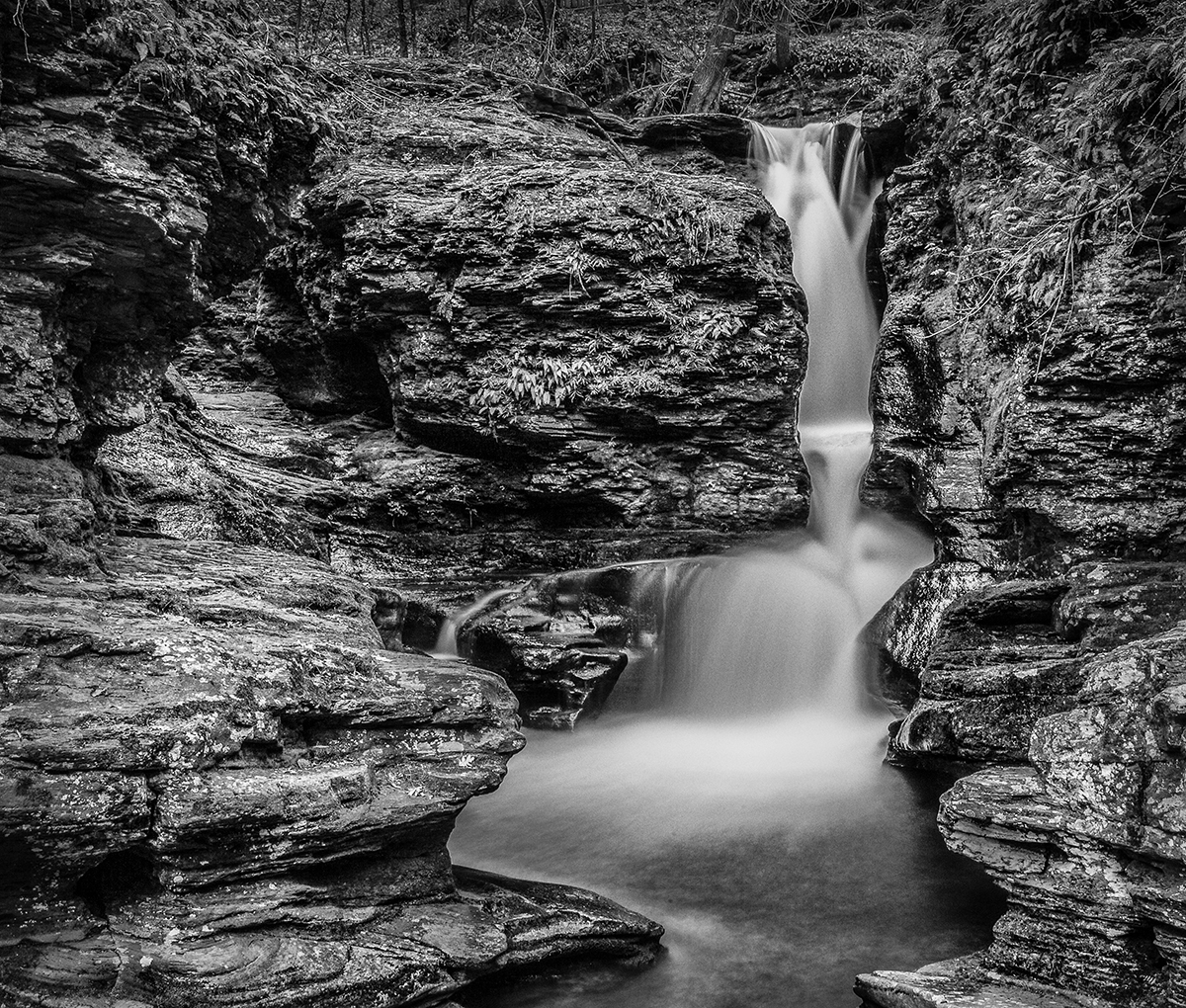
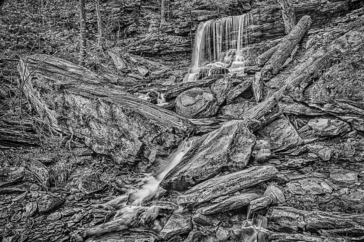
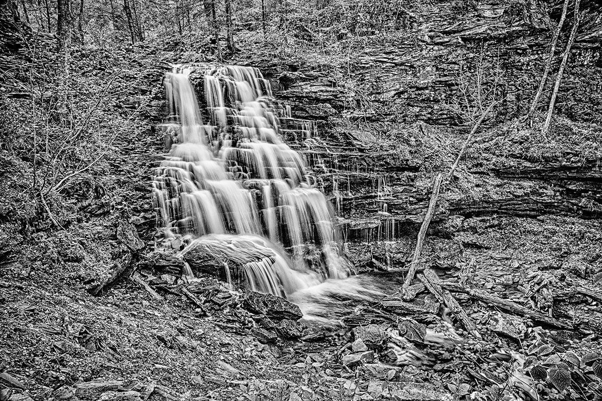
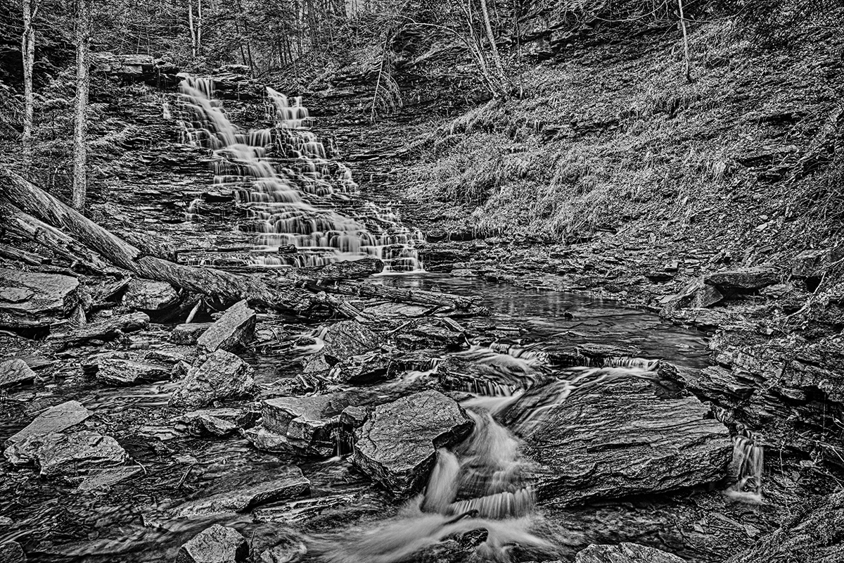
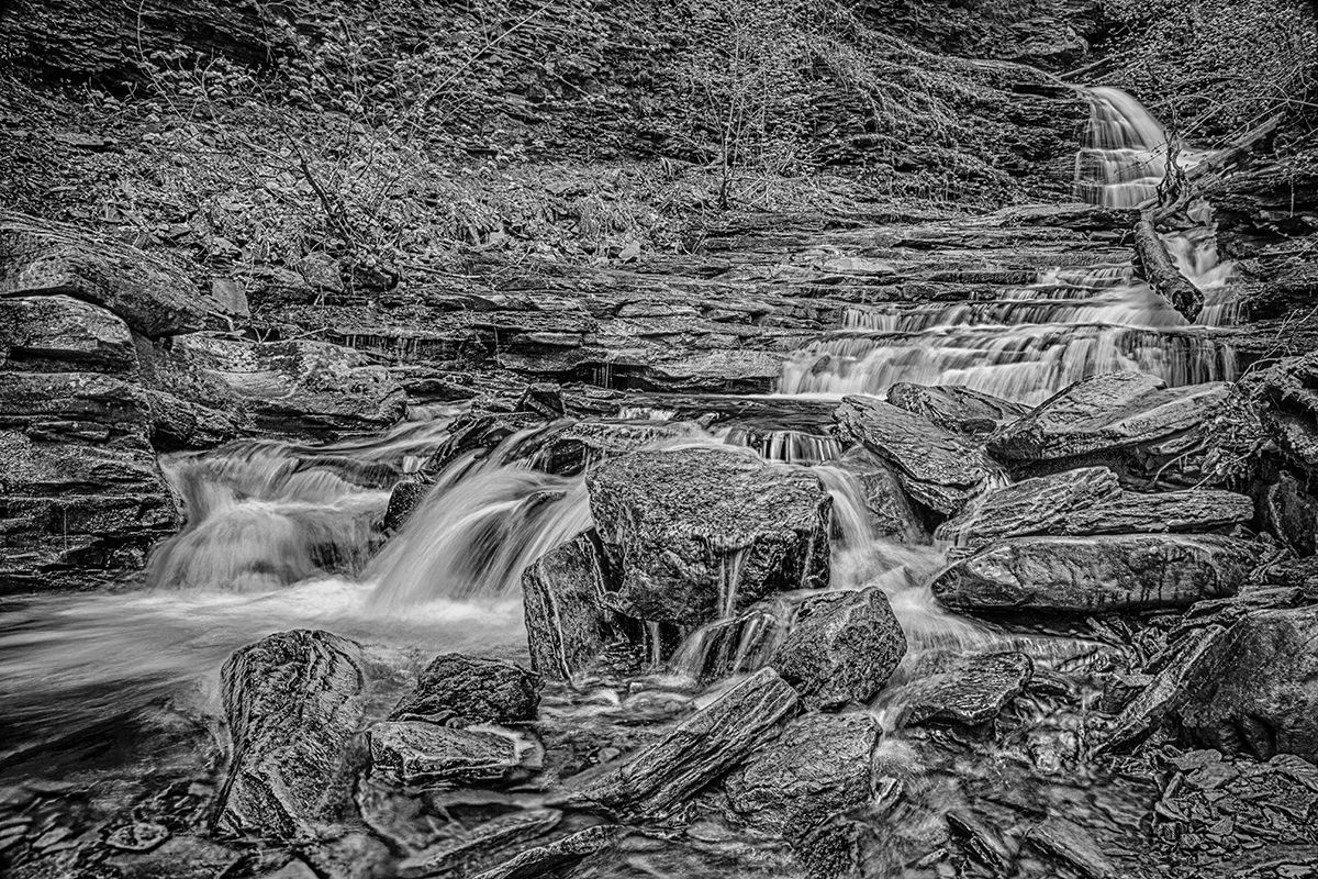
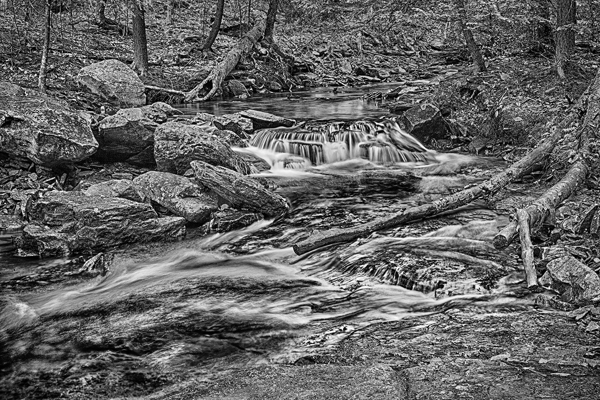
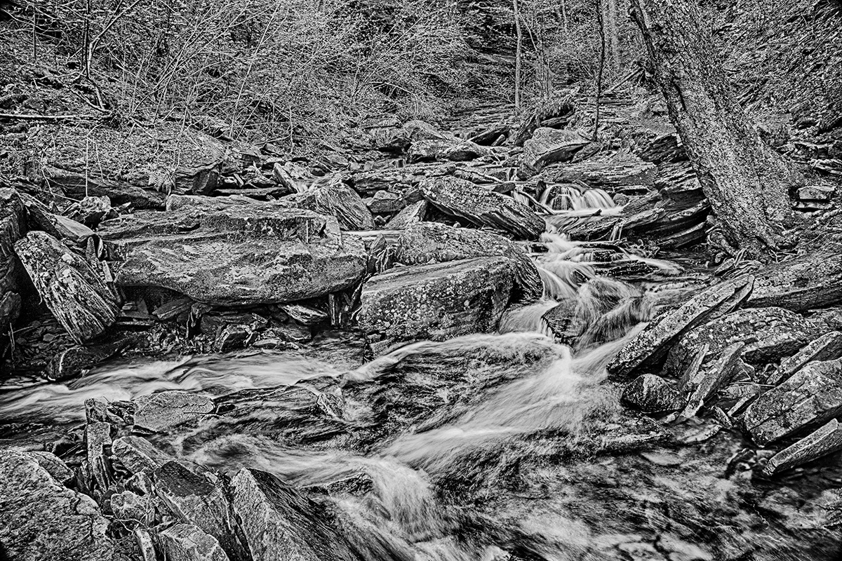
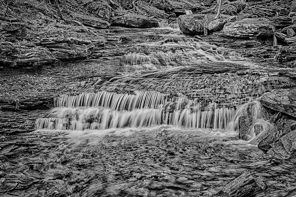
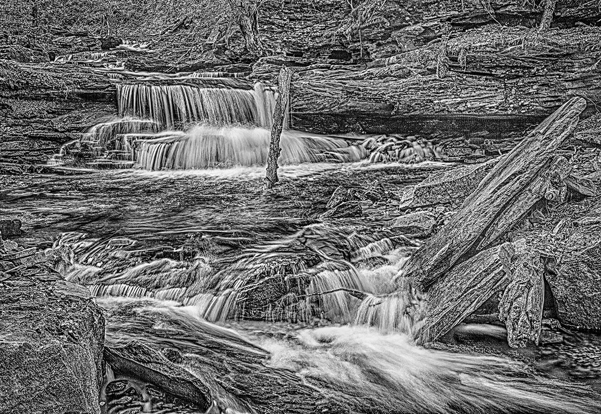
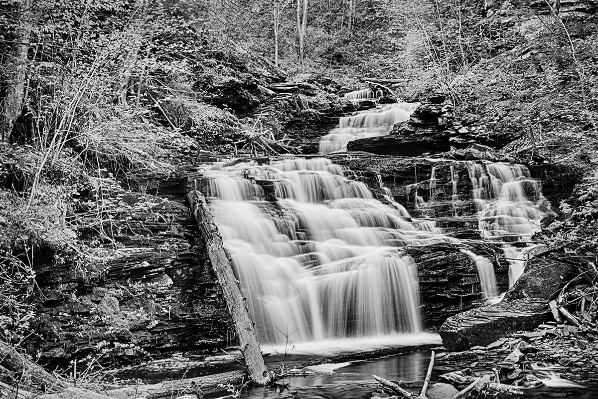
There are 24 named waterfalls in Ricketts Glen State Park in the U.S. state of Pennsylvania along Kitchen Creek as it flows in three steep, narrow valleys, or glens. They range in height from 9 feet to the 94-foot Ganoga Falls. The park, which opened in 1944, is administered by the Bureau of State Parks of the Pennsylvania Department of Conservation and Natural Resources (DCNR). Nearly all of the waterfalls are visible from the Falls Trail, which Ricketts had built from 1889 to 1893 and which the state park rebuilt in the 1940s and late 1990s. The Falls Trail has been called “the most magnificent hike in the state” and one of “the top hikes in the East”.[1]
The waterfalls are on the section of Kitchen Creek that flows down the Allegheny Front, a steep escarpment between the Allegheny Plateau to the north and the Ridge-and-Valley Appalachians to the south. The glens are made of sedimentary rocks from the Huntley Mountain and Catskill Formations that formed up to 370 million years ago in he Devonian and Carboniferous periods. The waterfalls are the result of increased flow in Kitchen Creek from glaciers enlarging its drainage basin during the last Ice Age.
Ricketts named 21 of the waterfalls, mostly for Native American tribes and places, and his family and friends. There are ten named falls in Ganoga Glen, eight named falls in Glen Leigh, and between four and six named waterfalls in Ricketts Glen. The DCNR names 22 falls, the United States Geological Survey (USGS) Geographic Names Information System (GNIS) names 23 falls, and Scott E. Brown’s 2004 book “Pennsylvania waterfalls: a guide for hikers and photographers” names 24. The falls are described in order going upstream along the creek for each of the three glens.
We made reservations and stayed on a farm bed and breakfast. The couple that ran the bed and breakfast were very friendly and our hostess was an excellent cook. Our Bed and Breakfast was only a few miles away from the Park.
Fortunately, it was cloudy most of the time we were there which helped us make the best use of our time since we had missed a few days of photographing due to my illness.
When we visited the waterfall area, we parked at the beach lot number 2 trailhead parking, then followed the trail to the waterfall trail. Everything is clearly marked. However, once you get to the falls there is some climbing and steps cut out of the rock formations. It also rained while we were there which made the rocks very slippery. In the early spring the flow of water over the falls may create a lot of mist which would not be the best environment. During the summer the vegetation can get to be an obstacle to getting a good photograph and, often times in the fall, there may be only a small amount of water flowing over the falls. So My recommendation for photographing this area is to go in the mid to late spring.
These photographs were taken with Canon 5D with a polarizer. ASA was set to 100 and the aperture was set to f16. I did use a tripod when capturing all images due to the long exposure times. Photographs were developed using Lightroom, Photoshop and Silver Efex Pro.
I especially like the abstract HDR effects of these images. It stresses the details present everywhere in nature if we just look for them.